Between the 31 and 32 Milestones - the first Ship Tavern
(The name and musket-ball riddled Tavern sign moved to Mile 25 by 1792)
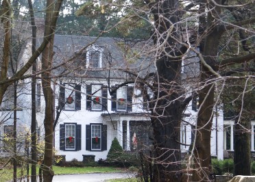
According to the Mowday's a John Edge had bought the old inn and turned it into a private residence by 1792. Today it is known as Glen Isle Farm country Inn and may be a Bed and Breakfast. It is a little tricky to find since the railroad roared through in the 1800's cutting it off from the Pike. It is located at 130 S. Lloyd Avenue between Downingtown and Thorndale. Some of its features include a front entrance with 2 sets of triple columns, a bay window on the East end, 2 big chimneys with a decorative 4 point topping and a sun porch on the West end. The drive leading up to it however is marked as a private road. *Above banner image, Leaping Deer, was taken between Coatesville and Lancaster, PA. on the Lancaster Pike.
Old Caln Historical Society Resets Historic Mile Marker
7/12/2019 Old Caln Historical Society Resets Historic Mile Marker along Former Philadelphia and Lancaster Pike (Now Lincoln Highway)
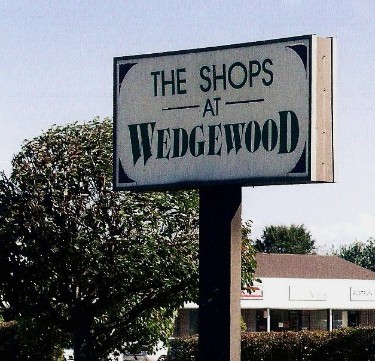
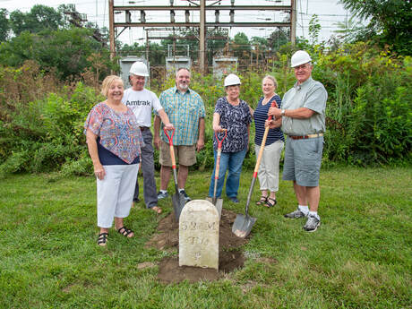
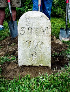
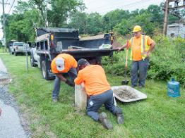
Caln Township, PA: The Old Caln Historical Society, a local non-profit organization dedicated to researching and sharing the history Caln Township, has embarked on a new project to locate, reset, and document the historic stones which were once erected to mark each mile between Philadelphia and Lancaster. This week, the society, with the help of Caln Township Public Works, reset mile marker 32, in what they believe to be its original location across from the Wedgewood Shopping Center on Lincoln Highway.
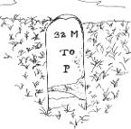
Brenda Porter, who has headed up the project said she and another member, Lois Demchak, were chatting about the mile markers and lamenting the fact that many are missing when Lois remembered that one of the markers had been donated to the Township after many years in a private home. Porter located the marker and coordinated the effort to reset it with Caln Township and PennDOT (who owns the property where the marker was set). The marker reads “32 M TO P” meaning 32 miles to Philadelphia. Other markers down the line add “M TO L” for “Miles to Lancaster.” Since the Philadelphia and Lancaster Pike was constructed in 1794, the marker could be as much as 225 years old.
Additional nearby markers include:
Mile 31 – located on the North side of Lincoln Highway in front of the Janwood Apartments in Downingtown
Mile 33 – marker is missing, but it would be located near the Happy Days Diner in Thorndale
Mile 34 – located on the South side of Lincoln Highway near Barley Sheaf Road
Mile 35 – built into the stone wall near Veteran’s Drive in Coatesville
Mile 36 – missing, would be located in Coatesville near Pennsylvania Ave.
The Philadelphia and Lancaster Pike operated as a toll-road with log turn-stiles serving as gates wherever tolls were collected. It was one of the first turnpikes in the country.
The Old Caln Historical Society asks anyone who knows the location of any of the missing markers, to please contact Abbey at aswan@calntownship.org or 610-384-0600 x148. This is the article from The Old Caln Historical Society. I only had permission to use the picture but felt their article told the story behind it's resetting. It is their work! Please contact me if I need to delete it. Bill
Milestone 32 - It's Back!
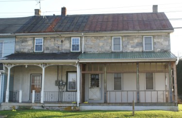
According to Ness, the Gallagherville Tavern is in this area as well. I found and photographed the building he had in his book but not sure if it's really the Gallagherville. Sachse said the tavern was near the 33 mile point and my research indicated it was demolished in 1897. It had opened in the early 1800's as The Wagon, had burned in 1844 and was rebuilt in 1846. The Gallagherville Tavern name may have been transferred to a new location which would explain why it's still attached to a building.